3-15-2014: Anchored out in the beautiful, clear blue water by Manjack Cay, Abaco, Bahamas

Friday, April 8, 2011

Previously posted pictures from February 16 through 20, 2011

First barge since the Tenn-Tom
Another beautiful sunset


Kids canoe  tipped over because of wind;
waiting here for a ride
Busy marina for the
Festival of Light


2-19-2011 firewords
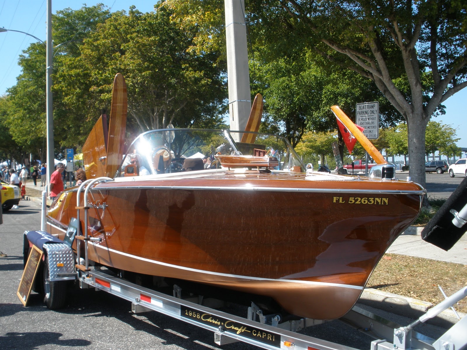
1958 Chris Craft Capri


2-20-2011 Car Show in Fort Myers; sorry Ronn,
no mustangs but lots of others Fords
Keith is a Jeep guy (Fort Myers)


Kim Jo III from the dinghy

I really like this sunset 2-12-2011

Tuesday, April 5, 2011

April 1 through 5 -Friday through Tuesday

April 1-Friday-Isle of Hope Marina to Savannah Bend Marina, GA:  We just had a short ways to go today.  Said good-bye to John and Sue and got to Savannah by 11:00.  Got fuel at Savannah Bend Marina as they had a real good price; $3.89/gal where other marinas in the area were .40 to .50 cents more a gallon.  When backing into our slip we had one heck of a time; the wind and current were real strong.  All the guide books say that from Georgia through North Carolina to be prepared for strong currents.  We had a good dock hand who was very helpful.  We spent 2 days here; it felt good to rest up.  We ate at a local pub that served steamed shrimp and crab.  They used newspapers for table clothes and paper plates, etc. so after you were done eating all they had to do was take the silverware off and then roll up the newspaper and plates.  The waitress said it made clean up very easy.

N32 02.142
W81 02.740

April 3; Sunday-Savannah Bend Marina to Factory Creek anchorage-We were on the waterway by 08:45.  Again, it was very strong currents and strong winds.  We crossed the Savannah River into South Carolina at Mile 576.0, but first we had to wait for a huge cargo/container ship going to City of Savannah with what looked like a load of cars, trucks, etc.  They also had a Yacht sitting on top that looked like about 45 feet long.  The cargo ship had to be at least 800 feet long.  After crossing the river we went through Caliboque Sound and Port Royal Sound; both were pretty smooth considering the winds and the outgoing tide.  In Port Royal Sound we passed Parris Island, the USMC boot camp for new recruits from the east coast.  We anchored in 8.5 feet of water on Factory Creek just outside of Beaufort, SC, at low tide.   The creek had houses on one side and marsh land on the other.  There was a nice man out washing his boat and he told us where to anchorage and not to worry about swing room as the creek was deep on both sides.  He even offered his dock for our dinghy if we wanted to go ashore, which I though was very nice.  We had a real good hold on the anchor and a nice night.  The tide rose 9.5 feet between 16:00 and 22:00.  The marsh next to us became a lake.

N32 25.253
W80 39.131

April 4; Monday-Factory Creek Anchorage to Lady's Island Marina:  We just went a mile or so back down the creek and stayed at Lady's Island Marina because there was a bad storm heading our way.  We stayed there for 2 days.  We didn't want to anchor out in the storm and the next marina was 66 miles from here.  The storm hit early on Tuesday morning with thunder, lightning, and very strong winds.  An unattended sailboat was tied up to a personal mooring ball and winds were so strong it dragged the boat at least 1/2 mile where it ran into someones dock; don't know if there was damage or not.  We were just glad it didn't run into us.  The rain stopped by about noon but the strong winds kept up all day.

N32 25.186
W80 39.468

CO's comments:  I sure am glad that we decided to move from an anchorage to a marina and tie up.  Today (Tuesday)  there were wind gusts of over 40 mph.  It was quit a sight to see a sailboat going down the creek, dragging it's mooring ball.  Even our friends that we were with last week in a thunderstorm decided to find a marina to stay in and we were glad.  Use the heaviest anchor that your boat will tolerate and don't skimp on mooring lines-bigger is better.


Rising tide at Savannah Bend Marina
Still  3 feet to go

Sunrise at Savannah


Container ship on the Savannah River
(see Yacht on top)
USMC Boot Camp on Parris Island
from the ICW

Saturday, April 2, 2011

Tuesday, Wednesday,and Thursday March 29, 30 & 31, 2011

Tuesday - Jekyll Island to Anchorage-New Teakettle Creek:  We were traveling with Debrief and left at 10:30 in order to reach Mile 655 on the Mud River (which is supposed to be the worst shoaling on the ICW) at mid to high tide.  We went through St. Simons Sound and Buttermilk Sound; both a little rough, before we reached our anchorage at Mile 647.0 on New Teakettle Creek.  So far what we have seen of Georgia has not impressed us; a lot of swamps or marsh lands is what the chart says.  Our anchor held good in about 18' of water with a 7' tide but there wasn't a tree in sight for miles.  It was a windy day but no rain.  The wind died down after dark.

N31.45918
W81.30186

Wednesday - Anchorage Mile 647.0, New Teakettle Creek to Isle of Hope, GA:  We got going at 08:15 to try and beat the thunderstorms predicted for about 12:00.  We went through Sapelo Sound and went up Johnson Creek to North Newport River and into St. Catherine's Sound.  Both sounds were relatively smooth for a change.  The thunderstorms started at noon as predicted and we kept on going.  We broke one of our rules-Never travel in a thunderstorm.  We skipped our planned anchorage and kept going to Isle of Hope Marina, just south of Savannah, GA.  A very long day; 57 miles and 7 1/2 hours; we all were tired of traveling in the winds, rains, thunder and lightning.  The marina had a loaner car so we went to dinner at a local pub.  It was very good.

Thursday - We stayed another day and got the night for half price because of weather delay-good deal.  It was a rainy day so we got together with 2 other boaters and drove into Savannah and took a tour of the city.  It was one of the nicest things we have seen so far in Georgia.  It is a beautiful downtown area and worth seeing.  After getting back Sue and I took the car to a Super Walmart to stock up.

N31 58.835
W81 03.352

Debrief-43' North Pacific
Pilot House Trawler
John and Sue on our tour


Bob-has a Mainship 390 Trawler
and is doing the Loop by himself

Cathedral of St John the Baptist formed
in the late 18th century - Beautiful church


Downtown Savannah has all kinds
of horse drawn carriages
One of the many park statues in
downtown Savannah


CO's comments:  Rain, thunderstorms, poor visibility, narrow channels, shoaling, low water, lightning, and no windshield wipers.  We had to rely on the chart plotter, paper charts, and Debrief, who was in front of us.  It was a long hard day.  There was one bright spot.  A 50' Sea Ray Sundance asked to do a slow pass and then pulled along side and asked me to go to Channel 68.  He identified himself as Rusty Higgins working for Sea Ray.  He recognized our boat and said he put the gel coat on our hull back in 1989.  He gave me his address and said if we needed any information on our boat to contact him. After he did another slow pass by Debrief, he was out of sight in seconds-hate to pay that fuel bill!

Monday, March 28, 2011

March 23 thru 28, 2011

Wednesday-Titusville to Daytona Beach:  Had to wait for the fog to lift before leaving this AM.  Not much happening today.  Had one narrow opening for a bridge and a lot of no wake areas.  In the New Smyrna area there was real bad shoaling and the channel was very narrow and shallow both in and out of the channel at times.  We anchored at Mile 832.0 by Daytona Beach.  We had very, very, strong winds.  Ran the generator for dinner as it was too windy for the grill to start.  Went over charts and guidebooks looking for anchorages for the next few days-they are few and far between.

N29 11.751
W81 00.152

Thursday-Daytona Beach to St. Augustine:  Had a little trouble getting the anchor up this AM; at first we thought it was the wind but after checking it Keith said the tension was loose on the windless, probably did not get tighten enough after repairs were done.  This is a different part of Florida from that we have seen in the past.  Some areas there were houses real close together and very close to the water with no yard to speak of and others had great big houses and very plush yards; the nicest houses we have seen so far on the east coast.  We anchored out just north east of Bridge of the Lions, Mile 777.8, on the Matanzas River outside of St. Augustine, FL.  It was still very strong winds when we went to bed.

N29 53.736
W81 18.388

Friday-St. Augustine to Jacksonville:  We had a terrible night with the strong winds.  Keith was up at 03:00 to check on the anchor and all was good.  At 04:00 it was a different story.  It was so bad Keith stayed up on the bridge to keep an eye on the anchor.  The wind and current were throwing us all over the place.  He told me to sleep but I was up by 04:45 and helped him watch.  As soon as we had daylight we pulled up anchor and were on our way.  From listening to the boaters on the mooring balls, just on the north west side of the river, they did not have a good night either; at lease we didn't have to pay to be uncomfortable.  One guy's mooring ball broke and it was hitting his hull all night and he was not happy.  We got to Jacksonville, FL, Palm Cove Marina early.  No sooner did we get tied up and High Spirits came in and tied up behind us.  Keith washed the boat and Ruth, Wayne, and I walked to the grocery store.  It was a nice night and we sat on the dock for drinks til about 19:00.  We went to the marina restaurant for dinner and were back to the boat by 20:30.  We were both beat from the night before; Keith went to bed and I fell asleep watching TV and woke up at 23:00.

N30 17.423
W81 25.861

Saturday-Jacksonville to Fernandina Beach:  Got going early and only had 32 miles to go for the day.  Another quiet day.  We were prepared for a rough crossing where the ICW crossed the St. John's River but it went smooth.  But the rough crossing was at the Nassau River.  We stayed at the mooring balls at Fernandina Beach.  I had a hard time catching the pendent this time as it was very windy.  I am beginning to think it is always very windy on the east coast.  The 2nd time I finally caught it but it was so slimy and dirty and the ring weighted about 10#'s.  Our clip on our bridle was too small to go around the pendant ring.  By the time we got hooked up properly I was dirty and exhausted.  We ended up taking our clip off our line and just using the rope and making the bridle a little shorted.  It worked.

N30 40.238
W81 28.179

Sunday and Monday-Fernandina Beach to Jekyll Island, GA:  Waited for the tide to be right before leaving this AM.  Tides lately have been between 6 and 7 feet.  We traveled with John and Sue; Debrief, today.  It was a nice day with not as much wind.  We crossed the St. Mary's River (Cumberland Sound) into Georgia about 10:10.  Between Miles 711 and 708 is the Navy's Kings Bay Submarine Base, a restricted area with very confusing markers.  If it weren't for John we might have missed the turn and gone in the restricted area.  We saw wild horses on the Little Cumberland Island and we also saw a Sea Ray that went hard a ground and was waiting for BoatUS.  Glad it wasn't us.  We crossed St. Andrews Sound and it was pretty rough for a while; about 3 to 4 feet seas; we were in a rising tide.  We then went right into Jekyll Creek and to our marina; Jekyll Harbor.  Again, it was very windy going into the docks.  We made it OK but John and Sue had a little mishap.  They made him parallel park his boat in the strong winds and a small slot; he hit another boat; no damage to the other boat but they had some torn screens and a dented pole.  Had docktails and went to dinner at the little restaurant here at the marina; we were not impressed.  Had thunderstorms this afternoon, during the night, and on and off on Monday.  Decided to stay over an extra day to get caught up on things.

CO's comments:  Anchors - We have a 44 pound Shark Anchor that has held us firmly in 18 to 30 mph gusts, currents averaging 5 mph, and with overnight shifts in winds up to 90 degrees.  It must be noted that all we use is heavy chain rode which adds considerable weight in securing the anchor.  The further south that we have gone and the further east and north that we are going now, the more inconsiderate boater are and we have been told that it get worse the further north you go on the east coast.

N31 02.710
W81 25.363

A lot of houses right on the ICW
Bridge of the Lions at St. Augustine


St. Augustine sunset
Wedding party at St. Augustine, FL


Half of the day there is no water under boats
Mile 725 ICW-very long docks


Fernandina Beach Mooring Field
Fernandina Beach anchorage


Wild Horses at Little Cumberland Island
Dayton Beach anchorage


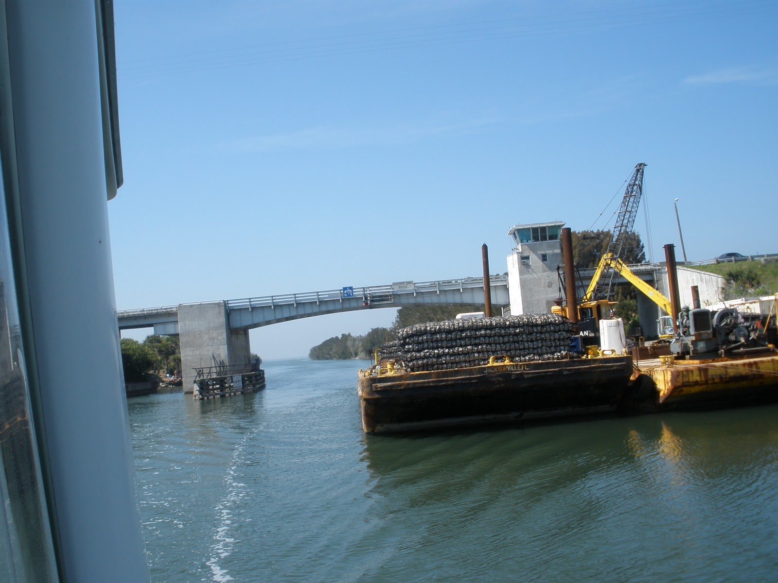
Haulover Bridge in ICW, Mile 869.2
Kim Jo III at Titusville, FL